The post Why Cyclones Tend to Move Towards Land appeared first on The Edge Media.
]]>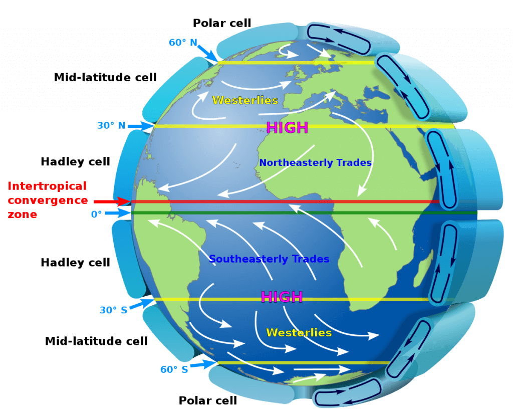 Cyclones generally form in tropical regions between 5º and 20º north and south of the equator. In these areas, trade winds blow from east to west as part of the global Hadley circulation. Warm air rises near the equator, moves toward higher latitudes, cools and sinks around 30º latitude, then flows back toward the equator. The rotation of the Earth deflects this returning air westward, creating the easterly trade winds.
These winds tend to push storms westward, which explains why cyclones in the Bay of Bengal move toward India’s east coast, Atlantic storms travel from Africa to the Caribbean and the Americas, and Pacific storms often head toward Asia and Australia.
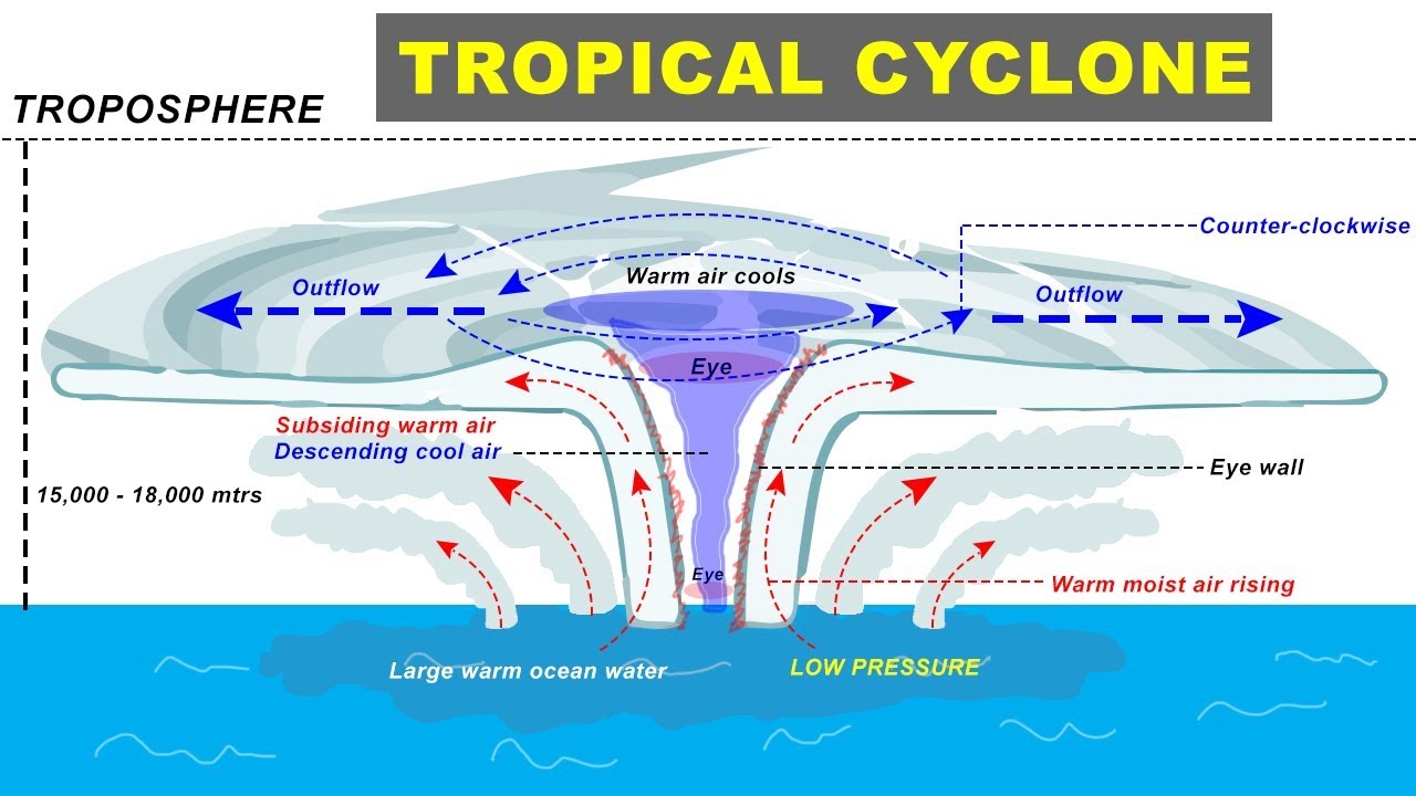 While cyclones gain strength from warm ocean waters offshore, the prevailing winds control their path. They may also interact with other atmospheric systems, such as mid-latitude westerlies, which can alter their direction. Sometimes this steers storms into open waters, but often they continue toward land.
For example, in December 2023, Cyclone Michaung lingered offshore for several hours before making landfall because the steering winds over the Bay of Bengal were weak.
In theory, if global wind patterns were reversed, cyclones would rarely make landfall and would drift over open water.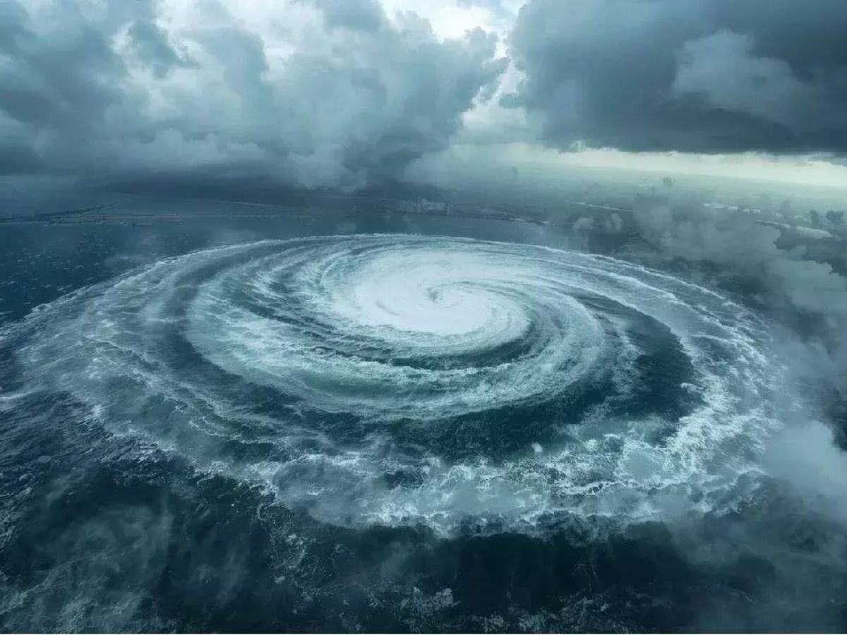 The Arabian Sea presents an interesting case. Cyclones there could be expected to move toward the Arabian Peninsula or Africa, but they often move toward India because of monsoon winds. During the southwest monsoon from June to September, surface winds blow from the southwest toward the northeast, steering storms toward India. This explains why cyclones in the Arabian Sea frequently hit western India, including Gujarat, Maharashtra, and sometimes Kerala
Outside the monsoon season, the northeast monsoon brings dry air from the Indian subcontinent toward the equator and Africa, which can push cyclones westward. However, formation is less likely in winter and early spring due to cooler waters and stronger wind shear.
The post Why Cyclones Tend to Move Towards Land appeared first on The Edge Media.
]]>The post Cyclone Expected to Hit Andhra Coast Near Kakinada on October 28 Night appeared first on The Edge Media.
]]>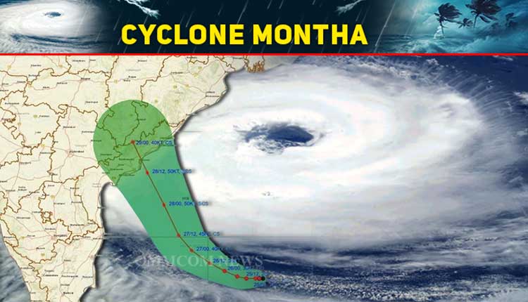 On Saturday (October 25), the IMD reported that the depression over the southeast Bay of Bengal had moved westward and is likely to intensify first into a deep depression by Sunday (October 26) and later into a cyclonic storm by Monday morning (October 27), over the southwest and adjoining west-central Bay of Bengal.
To assess preparedness, Cabinet Secretary T. V. Somanathan convened a meeting of the National Crisis Management Committee (NCMC). Senior officials, including the Chief Secretaries of Tamil Nadu, Andhra Pradesh, and Puducherry, and the Additional Chief Secretary of Odisha, briefed the committee on precautionary actions and evacuation measures being taken in coastal regions expected to be affected by the cyclone.
Authorities have urged residents in low-lying and coastal areas to remain alert and follow official advisories as the system continues to intensify.
The post Cyclone Expected to Hit Andhra Coast Near Kakinada on October 28 Night appeared first on The Edge Media.
]]>The post PM Modi Stresses On Regional Security Post Europe Instability At BIMSTEC 2022 appeared first on The Edge Media.
]]>“Recent events in Europe have cast doubt on the international order’s stability,” Prime Minister Modi stated. “In this scenario, it is critical to strengthen BIMSTEC regional cooperation,” he said, noting that “regional security is critical now.”
The post PM Modi Stresses On Regional Security Post Europe Instability At BIMSTEC 2022 appeared first on The Edge Media.
]]>The post IMD predicts that after Gulab, another cyclone named ‘Shaheen’ will form over the Arabian Sea appeared first on The Edge Media.
]]>
The IMD said in a tweet, “Depression lay centered over Telangana and adjoining areas of Marathwada and Vidarbha to weaken into a well-marked low-pressure area during next six hours: India Meteorological Department.” One team of NDRF is being prepositioned at Osmanabad, Maharashtra: National Disaster Response Force (NDRF).
The post IMD predicts that after Gulab, another cyclone named ‘Shaheen’ will form over the Arabian Sea appeared first on The Edge Media.
]]>The post Low pressure likely to form on June 11 over Bay of Bengal appeared first on The Edge Media.
]]>Under the influence of the low pressure, most of East India and adjoining central India will likely witness fairly widespread rainfall activity from June 10 onwards.
The weather department further added that due to the strengthening of southwesterly winds from Bay of Bengal to Northeast and adjoining East India, a cyclonic circulation will be formed over central Assam and neighbourhood, including West Bengal and South Chhattisgarh.
These areas will likely witness widespread rainfall activity over the next four-five days.If the low pressure converts into cyclone, India would witness third cyclone — after Tauktae and Yaas — within weeks.
Cyclone Tauktae was formed on May 14 and dissipated on May 19. Tauktae was formed in Arabian Sea. Just a week later, Cyclone Yaas hit the eastern coast of the country. It was formed on May 23 and dissipated on May 28.
In its latest update on Monday, the department said that a low pressure area was likely to form over North Bay of Bengal around 11th June. Southwesterly winds over Arabian Sea was also likely to strengthen from 10 June.
Monsoon is likely to advance into remaining parts of Maharashtra (including Mumbai), Telangana and Andhra Pradesh by 11 June; Odisha, West Bengal, Chhattisgarh, Jharkhand, Bihar, East Uttar Pradesh, some parts of Madhya Pradesh, and Gujarat state during 11-13 June,” it said in a statement issued on June 7.
The post Low pressure likely to form on June 11 over Bay of Bengal appeared first on The Edge Media.
]]>